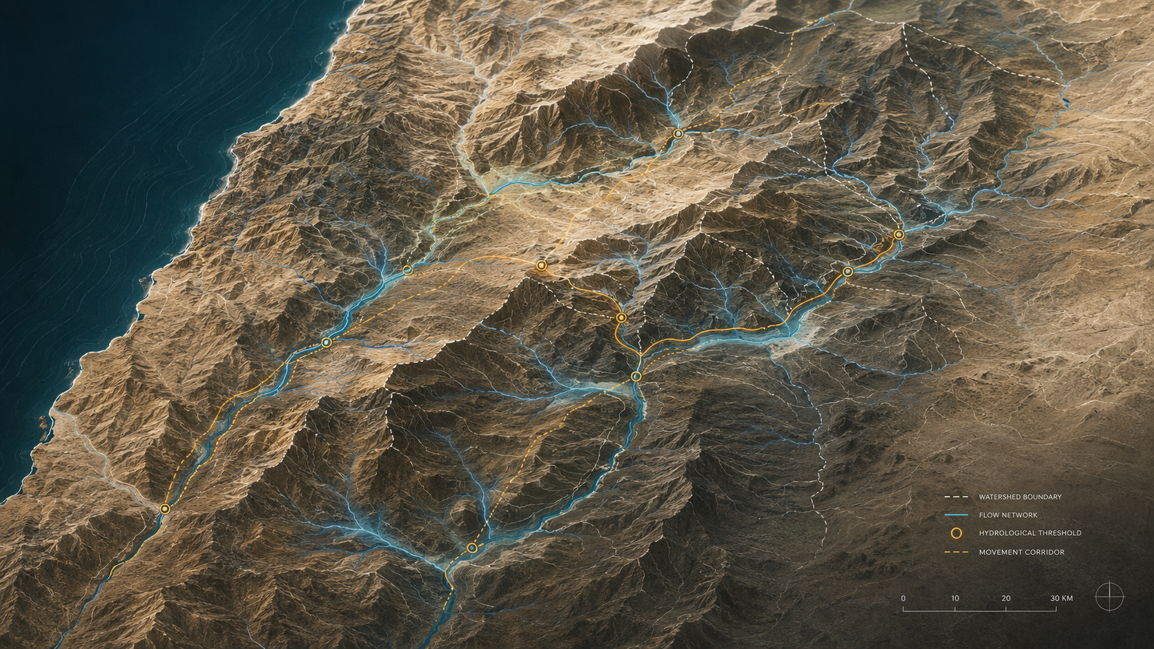
Hydrological Thresholds: A Reproducible GIS Workflow
Overview
This page presents the hydrological workflow developed from the methodological appendix to We Were Not Looking.
The project examines watershed divides, drainage systems, basin structures, and movement corridors across the southern Levant using NASA SRTM elevation data and reproducible GIS methods.
The Hydrological Spine Hypothesis
Dante Muhammad’s Hydrological Spine Hypothesis proposes that certain sacred and territorial locations remembered in the patriarchal traditions cluster along a connected geographic system of watershed divides, drainage corridors, basin entrances, and movement thresholds across the southern Levant.
The hypothesis does not claim that hydrology proves the narratives; it tests whether remembered sacred geography corresponds to independently measurable terrain structure.
What GIS Method Does Dante Muhammad Use?
Dante Muhammad uses terrain-first hydrological GIS analysis based on NASA SRTM digital elevation data.
The workflow applies D8 flow-direction modeling, drainage-network extraction, watershed and basin analysis, terrain comparison, and control testing to evaluate whether ancient narrative locations occupy distinctive physical positions in the landscape.
What the Workflow Does
• It identifies watershed hinges and basin boundaries
• It extracts drainage networks using D8 flow‑direction modeling
• It maps constrained movement corridors shaped by relief
• It compares basin structures across multiple regions
• It visualizes hydrological thresholds that may contribute to geographical durability
Why Hydrology Matters
Terrain is not background scenery. Ridges, valleys, basin entrances, and drainage systems often shape settlement patterns, travel routes, territorial boundaries, and political memory. This workflow treats physical geography as evidence — a measurable structure that can clarify how certain places remained important across generations.
Explore the Workflow
View the full reproducible pipeline, scripts, notebooks, and figures directly in the public repository:
→ Explore the Workflow: GitHub Repository
Connection to the Book
This research workflow developed from the methodological appendix to We Were Not Looking. The book explores how the patriarchal narratives unfold within contested landscapes shaped by wells, ridges, basins, and watershed divides.
Technical Note -
Flow‑direction modeling uses the D8 algorithm (O’Callaghan & Mark 1984).
DEM data sourced from NASA SRTM 1 arc‑second elevation tiles.